Friday, December 5, 2008

happy winter


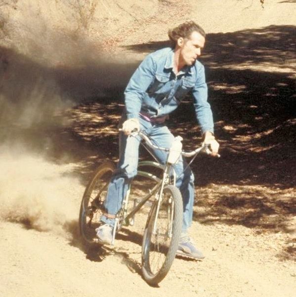
nothing like a late fall trip to the desert. Name them trails

Thursday, November 13, 2008

NORBA (No One Rides Bikes Anymore)

Or so it would seem...
Anyone go on any decent rides as of late? Lewis & Clark / Pipestone? Anything still dry?
....Bueller?.... Bueller?

Wednesday, November 5, 2008

Heck yes we can!

Now that we have that out of the way, go ride before winter sets in.

Tuesday, November 4, 2008

GET OUT & EXCERCISE ...Your right to vote!

Polls close at 8:00pm here in Montana.
Bike to your polling place & vote with the little rippers in mind!

If you don't know where you need to go, go here.

Monday, November 3, 2008

Riding Tip # 1 - How to rail berms like a pro

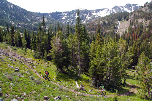
I finally put down the tool belt this weekend and dusted off the trail bike and headed up to the new Leverich trail for some much needed and well deserved saddle time. I'm glad to see there is the possibility of an honest to goodness DH trail in Bozeman, many props to all who have put sweat into development this far - thanks guys. I would have loved to help early on, but my house wasn't renovating itself, so I had to help it along for a bit.

Anyways, onto the point of this post - I'm going to go ahead and give a shot at posting a few riding tips once in a while. Since the new Leverich trail is likely to many riders in Bozeman the first time you have been exposed to real bermed corners, I thought it would be a good idea to give a how-to on berm riding technique. Knowing how to ride berms not only increases the fun factor for you, but also helps keep the berms from getting blown out. I will only hit on one basic technique this go round, but it should be enough to get you started. I could start an entire separate blog on just berm technique alone. Refer to the photo for reference, that is Gee Atherton, the current World Champion, and obviosly he has this down.

Well here goes...

1. Let's start by setting up for the corner. As like many things, cornering is only as successful as your preparation. All of your braking should be done before you even enter the berm (or any corner for that matter). Gradually apply your brakes in the smooth area approaching the corner while your bike is still upright - braking while cornering through a berm will naturally upright your bike and cause you to blow the corner wide.

2. Now that you have scrubbed your speed, keep a finger on your levers (just in case) and you are now ready to initiate your turn. Apply pressure to your outside pedal by dropping said outside pedal, while you begin to lean into the turn. This will help naturally distribute your weight over your tires. Keep your arms bent and keep your head over your front axle. You may feel more comfortable taking your inside foot off the pedal for confidence, but try to leave it on, or work to that point.

3. The most important piece of advice I can give on mountain biking in general is look where you are want to go. At all times through this corner, your eyes and head should be looking a few yards down the trail. Lead with your head and your bike will follow. Once you have made it to the mid point of the corner, your should switch to looking out of the exit of the berm and down the trail. Now, if there is no one coming up trail you can initiate your exit. (otherwise, shut it down!)

4. Drop your butt back over your rear tire slightly as you level your feet again with the inside foot leading (you should be still looking down the next straight, remember - look). As your bike has started to upright, your weight should naturally be slightly over your rear wheel and have a good amount of traction so you can give a few cranks and regain speed for the next straight. If all went well, congrats - you just railed it!

As I said earlier, this is just one technique, and I promise it won't be prefect for every berm. Some flatter berms require your cranks to be level to the ground, or your tires will slide over the top with the extra weight. My best advice is to work within your limits and keep practicing. On the way up the trail, you may want to stop and try a certain corner a few times. Before any downhill race, I will have ridden each corner individually many, many times before they ever do a full top-down run.

Two final pieces of advice I will give are some of the best lessons I have learned in my racing career. Keep a smile on your face (seriously, it works) and take it slow and easy - If I am aggressive, I will blow it. I cannot think of one course record set or race won where I did not go into it with the mindset that I was just going for a leisurely ride - I promise that with that mindset you will be at the top of your form.

Good luck & Happy Trails!

Monday, October 27, 2008

Don't build jumps on the Leverich DH!


We recently heard the following from the forest service in reference to the jump pictured:

We need to get the word out that this is not acceptable on the
main Leverich route. We have talked about doing something like this on
spur, off shoot parts of the trail, but need to have further discussions
with the Bozeman Ranger on some of this before any work is done.


Here's the deal on the trails as far as I know it from the two meetings I attended with the Forest Service with Greg and Jason and the extremely large number of emails that bounced around between everyone:

The big picture goal is an uphill trail and a downhill trail on either side of the canyon where the two new trails are. We were pushing for the "downhill only" designation, but that isn't something that can just be declared by the people we were meeting with. With that in mind, the western "downhill" trail was mapped and routed with an eye towards being a good downhill on a bike, and the "uphill" (eastern) route as a good climbing route. What it will take to get the "downhill" trail designated as such is still up in the air. Until then, both trails are multi-use, with an emphasis on mountain biking. We are going to try and get a sign up there very soon that recommends the uphill (and hiking)route and downhill route as such.

The amount of enthusiasm and work that this trail has been greeted with is more then I would have hoped for. We just need to keep it harnessed enough that we don't ruin our currently good relationship with forest service and jeopardize any further help from them. Everyone should know that they came to us with money to do this trail because bikers are the primary designated users of Leverich canyon. It's not cheap to cut a trail with an excavator like that. They are helping us out a lot, and in turn we need to play by their rules. This is not mountain bikers getting discriminated against. It's a huge step for us in the right direction.

This was cross posted from MTBR. Call me names if you want.

They also were not happy about these water bars being pulled off the old trail, they are needed to stop erosion on it so it can be reclaimed by the forest.

Sunday, October 26, 2008

North Cottonwood

I went for walk up North Cottonwood this evening. If you can handle the rocks, it's in really good shape for riding. The first mile or so through private land is dry, and once you get to the public land the trail is frozen, so that's effectively dry, too.
One of the most stunning views of the valley is up there too. Good times. But not easy.

-DNA

Friday, October 24, 2008

Anything dry(ish)

Anyone been up Sypes or Leverich today?

Wednesday, October 22, 2008

National Park Service Changes Stance on Cycling

A proposed National Park Service (NPS) regulation change will benefit Americans by improving mountain biking experiences in national parks. The new policy would empower park superintendents to manage trails for bicycles, without sacrificing environmental review or public comment opportunities.
"Bicycling is a good fit for many national parks. It's a quiet, low-impact, family-friendly activity that provides a great way to get adults and kids excited about exploring America's most scenic places," says IMBA Executive Director Mike Van Abel. "We're very pleased that the NPS intends to update its regulations to better serve visitors."
IMBA looks forward to an upcoming NPS announcement on the pending regulation change, and the ensuing public commentary period. Stay tuned to IMBA's website for additional news, and to register your comments with the NPS.

Bicycling Helps National Parks

Expanded opportunities for mountain biking can help energize national parks by attracting new visitors - particularly young ones. According to the Outdoor Industry Association, bicycling is the top gateway activity that gets kids outside and engaged in a variety of outdoor sports.
"Visitation numbers are a concern to the park service at all levels and something we are working with our many tourism partners such as IMBA to address. Having worked with mountain bikers on public lands at gateway communities, I know what a great economic impact they can have on a small town," said NPS National Tourism Director Dean Reeder. "In my experience, we can sustain a balance between resource conservation and appropriate, healthy recreational opportunities such as mountain biking.
Mountain bicycling on appropriate trails in national parks will also enhance visitors' appreciation for the natural world, as parks are better experienced on foot and by bicycle than from inside cars and RVs. Independent scientific studies, including those conducted by the National Park Service, have shown the environmental impacts of mountain biking are similar to those of hiking and less than those of many other user groups.

IMBA's Partnership With National Park Service

Since signing a formal partnership agreement in 2005, IMBA and the NPS have been working together to create and enhance appropriate opportunities for mountain bicycling in national parks. Currently, more than 40 NPS properties host mountain bicycling, on both dirt roads and narrow trails. Each year IMBA leads volunteer work parties to help improve eroded trails and unite trails communities around national parks. Annually, mountain bicyclists contribute almost one million hours of volunteer trailwork on public lands.
"Mountain bicycling is an appropriate activity in many units of the National Park System," says Christopher J. Stubbs, a NPS community planner in Virginia. "I have seen firsthand what bike trails can do for a park. IMBA's folks know how to build sustainable, environmentally sound trails that bring all user groups together. I see a huge potential for bringing a new generation of mountain bicyclists into the park system."

IMBA Has Requested Rule Change for Years

The current policy governing bicycling on NPS trails dates from 1986, and does not account for more than 20 years of research and experience managing bicycling on trails on public lands. The outdated rule is directed at motorized users such as personal watercraft, motorboats, snowmobiles, ORVs and commercial trucking, mining and aircraft. Regulation changes will streamline an overly cumbersome process, while maintaining all review and comment required under the National Environmental Policy Act.
"IMBA first began asking the agency to clarify and streamline this rule in 1992, when IMBA Executive Director Tim Blumenthal met with [then] NPS Director James Ridenour on the subject," says Van Abel. "We hope to see the process for recognizing mountain bike trails will now become more clear and efficient."

Monday, October 20, 2008

History Rock to South Cottonwood

Yesterday (Sunday Oct 19) we rode the History Rock to South Cottonwood shuttle. Conditions were all-in-all pretty decent. Since you can choose either trail as a single ride, I'll split them up.

I had my doubts upon leaving the H.R. trailhead, as there was snow immediately for the first 20 yards or so. The rest of the History Rock trail however, was decent 75% of the time, with 15% being a bit too muddy to ride responsibly and the other 10% being covered in a few inches of snow near the top. Give this trail a few days of dry and it should be tire-gripping tackiness from the meadow down.

Once you reach the sign at the top of the two trails, the snow drops away completely. I cannot recall seeing any snow on the entire South Cottonwood side. There is - to say, quite a bit of evidence of recent snow cover. I would say it is 50-60% wet. Still fun, but if we had not needed to get the shuttle motorcycle at the South Cottonwood trailhead, I would not have stayed off for a few days to maintain trail steward status.

If the weather outlook that I am currently looking at is correct (rain Tuesday, nice beyond that) either trail will likely be IN by the weekend. Definitely recommended for the upcoming weekend, just be back in town by 5:30 on Saturday.

Happy Trails!

Saturday, October 18, 2008

Garnet Mountain trail

Assuming anyone reads this, Garnet mountain is in decent shape, if you keep with it through the big snow patch you are rewarded with more dry trail once it starts facing south again. We went up to the junction with the ATV trail, you could probably ride to the top from there without hitting any more snow.

Any one else get out riding around here lately?

Thursday, October 2, 2008

Leverich Work Day

from Greg Beardslee:

"NEW DH Trail/Elevator Shaft Reroute in Progress

MANY VOLUNTEERS NEEDED

TRAIL WORK DAY, SAT. OCT. 4 9 AM - ?

MEET AT LEVERICH TRAILHEAD

BRING TOOLS IF POSSIBLE – PULASKIS, RAKES, MCLEODS, CHAINSAWS, PLASTIC BUCKETS, SHOVELS, LUNCH, WATER, RAINJACKET, AND WORK GLOVES ETC.

FREE BEER

Trail update The Forest Service has excavated a new trail using portions of the elevator shaft. Volunteers are needed to cut roots, pack dirt and contour the trail. Once this work is completed we can focus on trail flow, berms, and jumps. This will be the first official mountain bike/DH trail in the Gallatin National Forest.

If the weather is real bad, don’t show up, OK?" -Greg


As if you needed any more encouragement than being part of our first real DH trail, there is Free Beer.

-DNA


p.s. Free Beer

Friday, September 19, 2008

Blackmore to south Cottonwood


It's a tough climb up to the saddle below Blackmore, but the views of Alex Lowe Peak (and the 10(15?) mile downhill) will make it worth wile. Just follow the cairns from the trail junction sign. This weekend may be your last chance of the year. . .

Saturday, September 13, 2008

Clunker DH, Sunday 9-14

Sorry for the late notice, but we'll be having another Clunker DH this Sunday (tomorrow) at Moser. Meet at Spectator's at 1:30pm, we'll load up cars and head on over.

-DNA

Friday, September 12, 2008

Continental Divide Trail Work, this Weekend!

Email from Amy:
"The Montana Wilderness Association, Prickly Pear Land Trust, and the Helena Bike Club are putting on a pair of trail workdays on the Continental divide Trail north of Butte, Saturday and Sunday, Sept, 13 and 14. They have contacted IMBA and have an IMBA Trail Care Crew participating also. The Montana Mountain bike Alliance needs to put up a strong presence. Basically, the MWA and the Helena Club do not take us seriously. We need to put on a show of force. Our plan is to just go there for the Saturday session, but to show up in a big way.

It will help if participants sign up on the Prickly Pear Land trust website. Then they will have enough trail tools on hand. Also the Back Country Horseman are feeding us afterwards on Saturday, so by signing up they get a head count of workers.

This trail is being built as a result of the High Divide Agreement between Helena, Butte, and Anaconda bikers and the Montana Wilderness Association. The work area is up above Basin, MT. Exit 156 on I-15. 9 miles up Basin Creek road #172. ¾ mile past Winters Camp turn left on road #8513. Follow this for 4 miles to Joe Bowers Trailhead. I hope there is signage to assist us. A presentation by the IMBA trail crew is scheduled at 10 am."


-DNA

Tuesday, August 19, 2008

Shafthouse


The Shafthouse trail is in really, really good shape. Seems to be getting a lot of bike traffic, so if you aren't doing so already, go ride it.

Wednesday, August 6, 2008

Counterpoint?

From Dirt Rag August 1991.

Your trails were not meant just to hike
You can share them with my bike
for I enjoy nature too
and the climb to a mountain top to for a breath-taking view
and I hear the birds fuss at me
and I listen when they ask that I leave them be
and I thrill to see the baby bunny hop
across the trail and then suddenly stop
and sit up and look and sniff the air
then hop through the bushes to who knows where
and I watch amazed as a deer bounds by so strong and quick
more gifted than I
and I wonder if he gives a care
with what animals he must share
his trails and waters and woods so fair

Sherri Burford


Sent to me by Greg

Saturday, August 2, 2008

Clunker DH Details


Here's the details. We'll meet at Spectator's at 2pm (so you've all got plenty of time to get over your hangover) and we'll pack up and head on up to Moser. Greg knows that area well, so we can ride a few different trails and the road if we wanted an all-out drifting extravaganza. Casey can't ride yet, so he graciously offered to run the shuttle.
You can pretty much ride whatever bike you want, as long as it's not a mountain bike from 1990 - present. Cruisers, 80's era mtbs, whatevah.
Shoot me an email if you have any questions.

-DNA

New West Editor's communication

The following is an email exchange betwixt myself and the founder, publisher, and CEO of New West. This is shortly after he disabled the comments due to myself posting a link to the photoshop competition on TheBozemanFix.

New West Editor:

Casey, we're probably not going to chase you down for copyright infringement for stealing the photo, but we're certainly not going to be a vehicle for your prank.

If you think you and and some of the other MTBers on this thread have advanced your cause with this sort of rhetorical beat-down, I'd suspect you are mistaken.

Regards,
jw


My Reply:

Johnathan,

I'd say the sheer volume of the response should speak for itself. That article was nothing more than an attempt at bullying, so you shouldn't be surprised by a reponse in-kind.

Best,
Casey

New West Editor:

Casey, between you and me, I totally understand why the column ticked people off, and in fact I agree with most of the criticism. (And, in case you're wondering, I wouldn't know Jill if I walked into her on the street). But it's the comments, far more than the original article, that come across as bullying. A bunch of tough, aggressive MTB guys gang-tackling and pounding on a somewhat naive young woman...that's what I saw.

Regards,
jw


My Reply:

Johnathan,

That's your opinion and you're entitled to it. But this is an utter slap in the face to anyone who rides a bike and I am quite frankly shocked and dismayed that a seemingly reputable publication would print something so lacking in merit, justification, or quantifiable fact. This entire drama developed and unfolded because your innocent and naive ideologue choose to taunt a peaceful group of people doing something completely analogous to what she herself was doing that weekend. The sign saying 'fat chance fat tire' may as well have said 'fuck you'. That level of hypocrisy is unconscionable. I am generally a reasonable, if passionate, person (especially where cycling is concerned), but this vapid assertion of self-righteousness is so senseless and unfounded that I'm surprised that you felt any shock at our, in my opinion, defense of ourselves, in the face a tyrannical action by an unjust bully. It is nothing more, nothing less.

Incidentally, I am not the individual who posted a picture of JillCo. on The Bozeman Fix, although from time to time I contribute to that blog. Moreover, as far as I am aware that picture originated from this site.

http://www.utahmountainbiking.com/UMBphpBB2/viewtopic.php?t=4793

It appears to have been taken by a camera phone, most likely by one of the cyclists on that ride. So, as to your vague threat of lawsuit, I'm frankly confused.

Best,
Casey


Additionally I sent this:


Jonathan,

In addition to my prior reply, and along with the theme of my frustration with both Jill's article and your handling of it, I have this to say (after this, I will step off of my soapbox, I do of course invite your reply).

There are two individuals commenting on that post, who in their defense of your 'naive' guest columnist, go far beyond 'rhetorical beat-down' and threaten physical violence on us 'bunch of tough, aggressive MTB guys'. One of those individuals posts as mike and the other individual posts as bear bait; he goes beyond the threat of general physical violence and states that he will in fact use a gun. So be quite careful who you stereotype as aggressive here. All in all, from my brief experience with your publication (limited to Jill's article and my exchange with you) your theme seems to be impassioned opinion backed-up by little in the way of quantifiable data or verifiable fact, which make up the core of responsible journalism.

As I stated previously, it is my opinion that the voluminous rebuttal Jill's article received speaks, well volumes, and I dispute your claim of suspicion that we advanced our cause.

Best,
Casey

I then sent this:


Oh, and btw, since I happen to disagree with you about how this helps our 'cause', if I promise not to post links to sites promoting satire of my least favorite wilderness advocate, will you re-allow comments to the post?

Case

New West Editor's Reply:


Casey, the vast majority of the 180 or so comments are attacking and ridiculing the author, I already deleted the most personally insulting ones, since personal insults contribute zero to the dialogue (and are clearly against the rules). There was some good discussion for a while, which is the point of this kind of thing. New West publishes a wide range of stories and opinion pieces, partly in an effort to expose many aspects of an issue. As I mentioned we had invited a counter-point column before this was even posted, I am not sure what the status of that is.

I think the thread on this piece has run its course at this point, but we'll definitely have some more pieces on this topic where we can continue the conversation.

Regards,
jw

Friday, August 1, 2008

New West article comments

The editor of New West has posted this at the end of the comments.

Comments on this story are now closed, for obvious reasons (see terms of service). Any questions send me an email.

When I read it, I laughed and thought 'if you can't stand the heat...'

DNA has a post on TheFix about a little photoshop competition involving our fledgling 'journalist' and her friends.

C

Thursday, July 31, 2008

Clunker Downhill, This Sunday!


Old bikes, cruisers, anything but modern mountain bikes. This Sunday afternoon, probably Moser in Hyalite.
A few of us are going to get together for a nice Mt. Tam style clunker downhill. We'll shuttle via truck and send someone down first with a walkie-talkie to make sure the path is clear. Then we'll drink some cheap beer. So get your ratty old jeans and flannel (unless it's hot) and an old cruiser and stay tuned for the details. Nothing competitive, no prizes- just fun.

-DNA

Monday, July 28, 2008

Curly Lake

Curly lake is open now. Here's a gmap link that will get you near the trailhead. Basically once you get to Mammoth, keep going about 2-4 miles until you see what looks like some campsites, followed by some singletrack headed up a nigh impossible climb. Don't cross the creek. There's a sign that says Curly Cr. TR No 159. For actual directions Beartooth Publishing has this and many more rides very well categorized; this can be obtained at any local outdoor shop, bike or otherwise.

For those interested, but uncertain what this ride entails, some quite probably apocryphal statistics follow. It's around 25 miles and has about 5000 feet of elevation. I believe the 'official' description includes the word arduous. It also was hands-down my favorite ride so far...ever. So do it. Just take a lot of water and peanut butter.

A guy did the ride on a Big Dummy. At one point he pulled a barbecued chicken sandwich out of a FreeLoader...we were all envious...until we started climbing again.


Oh and, that's not a beer in the dude's hand on the left, it's a bottle of Glenlivet. Of course he was on a single-speed, so he probably needed something to numb the pain.

Protest update

They wrote a great article about their protest that probably won't help their cause.

Check it out at New West:

It was late when we left Missoula on a Friday night. We planned to sleep at the trailhead, wake early, hike in six miles, stay overnight, and fish and walk out seven miles the next day. We stopped to fill up our gas tanks in Dillon, where an article in the local paper caught our eye. We weren’t going to be alone in the Lima Peaks. A group of mountain bikers, the Montana Mountain Bike Alliance, planned to ride in the Garfield Mountain area in order to protest the pending wilderness recommendation. We weren’t happy about having to share the trails with the group, and, moreover, we weren’t happy about the intent behind their ride. We soon took matters into our own hands, laughing and tearing up a cardboard box. We were going to have a protest of our own.


The comments are REALLY good


By regular joe, 7-27-08
I love how pretentious city yuppies move to places like Missoula and then try to tell Missoula residents how they should live, where they should recreate, how they should recreate.

"Oh those mountain bikers -- they tried to KILL US with their high-speed fun! We were just walking along, 6-across on the trail, having a pleasant conversation about what a miracle Barack Obama is, and here comes this CRAZY mountain bike rider going at least 3 miles per hour! He tried to KILL US! We actually had to interrupt our impressively deep and sophisticated political conversation! CLEARLY mountain bikes should be banned!"

"Signed,

Peter Predenshus
Jill Konducenshun
Bob Sooperyer
Ted Eauppie
Gladys Cnobb"


Look for a response article from the MMBA in New West soon.


Trail report content: We "rode" from Bridger Bowl to the M yesterday on the Ridge. The trail was dry, the cornices were still large and in charge up on the ridge line.

Tuesday, July 22, 2008

Speaking of Emerald

Does anyone know if there are any planned travel restrictions on Emerald and Hyalite creek similar to what they're doing with Sypes?

Thx

Beaver Pond and Toll Canyon

I did Beaver Pond and Toll Canyon recently. The Forest Service has done a ton of work on Beaver Pond, including completely redoing the begining. It now starts about two hundred yards back down the road, look for the singletrack going up the hill. We parked down the highway on Fish-something road. Headed up the main highway to the Beaver Pond trailhead, road The Beaver Pond trail, and then back up the highway and did the Limekiln trail and dropped down toll canyon right back to the car.

Here's a site for a cycling club outta Butte with more info on rides around there.

Monday, July 21, 2008

Word on the Street- Emerald Lake

So dere's zis guy, you know?
Jay came in the shop the other day, said that he rode Emerald to the lake. There was some snow, maybe he had to walk a bit, but it sounded like it's pretty much ridable now.

Sorry, that's all I've got, since I didn't try riding it yet.


-DNA

Thursday, July 17, 2008

Period for comment ends Friday (7/18)

The period for comment about the new Forrest Service travel plan in the Lionhead area ends tomorrow (Friday July 18)!

Go here for IMBA's comment form to petition for continued access to these trails for bicycles.

Tuesday, July 15, 2008

Lima Peaks Fat Tire Festival


We got protested by wilderness advocates with signs on little sheep creek trail.

Ride report content:
Italian peaks loop is in and SICK. Ok, maybe it's a little hard to find but still good. Little sheep creek is good as well. GPS tracks will be appended to this at some point.

Tuesday, July 8, 2008

Sheep Creek, Coffin lakes

I went on the second two MMBA advocacy rides this weekend. Coffin lakes trail was in good shape all the way to the lake, as long as you didn't mind fresh cow pies too much. It was a good trail, but stormy weather and cramped quarters at the view point for the lake made it the lesser of the two rides.

Sheep creek was a real gem of a trail, one of the best mountain lake trails I've ever ridden. It was dry up to just about 9,000' (right Denny?)and featured a 3 mile high speed meadow section second to none.

There's Denny and someone whose name escapes me.


Here's the lake


Get out there and ride it, and write! Info here and from IMBA here and a easy to use form letter here.

Feel free to ignore the rest if you don't like looking at CSS.


#outer-wrapper {
width: 660px;
margin:0 auto;
padding:10px;
text-align:left;
font: normal normal 100% 'Trebuchet MS',Trebuchet,Verdana,Sans-serif;
}

#main-wrapper {
width: 410px;
float: left;


410 pixel width? optimized for all those people at 800x600 eh? Someone hates freedom. If this were my blog i'd do

#outer-wrapper {
max-width: 1000px;
margin:0 auto;
padding:10px;
text-align:left;
font: normal normal 100% 'Trebuchet MS',Trebuchet,Verdana,Sans-serif;
}
#content-wrapper {
width:auto;
}
#main-wrapper {
width: 66%;
min-width:400px;
max-width: 600px;
float: left;
word-wrap: break-word; /* fix for long text breaking sidebar float in IE */
overflow: hidden; /* fix for long non-text content breaking IE sidebar float */
}


(just joking, this blog is a great, thanks for letting me contribute)

Saturday, July 5, 2008

MMBA Advocacy Rides

I should have put this here earlier, but better late than never, right?
I got an email from Corey at Montana Mountain Bike Alliance a few days ago about some advocacy rides going on in the state. This weekend there's three:
  • July 4th, Continental Divide Trail at Mile Creek (yes, I'm aware that it was yesterday)
  • July 5th, Coffin Lake
  • July 6th, Sheep Lake
Meet at the Ridge Athletic club on Fallon. This is the new one that's out on the west side of town, not on Mendenhall next to Rocky Mountain Roasters.
These trails are in danger of being closed to mountain bikes by the Gallatin National Forest. I know that not too many folks from Bozeman make it out there, as it's a fairly long drive but they are crucial to the West Yellowstone mountain bike community. Go on these rides and write to the forest service about keeping these trails open. The comment period is over July 18th.
I went on the CDT ride yesterday with Corey and about 7 or 8 other folks. I've driven in the general area, mostly taking family past Quake Lake, but this was my first time riding in that part of the state. This trail and this area is among the most stunningly beautiful that I've ridden. All singletrack, you start climbing at a moderate grade through wildflower-ridden meadow. The trail makes its way into a drainage but stays lush and green while it climbs then falls in an undulating fashion (much like South Cottonwood). After a few miles of that, the trail starts with switchbacks, most of which are wide and fairly easy to ride. This section takes you up rapidly, with each turn providing another stunning view.
Then a rock broke my derailleur hanger, so that was the end of climbing for me. The others kept going, ultimately hitting snow and ditching their bikes to hike to the saddle and just into Idaho. I rode gingerly down since I had forgotten my bike shoes and I was riding with locked-out suspension and a single-speeded drivetrain. Despite this, the downhill was still incredible.
This is a trail that I'll definitely be going back to soon, but with my shoes. And a spare hanger. Get a few people together, carpool the best you can (and get the others to contribute to gas) and do the same. You don't want to miss this one.
Info Here.
If you have any questions, email Corey at cbiggers@rmtcinc.com.

Tuesday, July 1, 2008

New World Gulch

I knew it was going to be bad when I saw 3 signs at the trail head explaining how it was dangerous to go any further. I would say don't go up there until it gets fixed unless you like all of the following:

-Mosquitos in clouds
-Bogs in the trail
-Landslides
-missing trail next to the river
-slimy rocky creekbeds where the trail used to be

It wasn't horrible coming down (quite tricky), but I ended up pushing a good amount of the climb when I can normally ride most of it. Slimy rocks, trees, etc. I only went to where the trail dips down steeply before climbing to the meadow below Ellis. The horsemen had cleared the trail that far.

Anyone know if the state EVER gets around to fixing trails or are we out of luck on this one?

Monday, June 30, 2008

Blackmore

Blackmore trail is clear up to the lake only. Then it's massive blow down and more then massive snow. Gonna be a while for the high stuff.

Sunday, June 29, 2008

Bangtail Divide 6/29

I will declare the BDT 98% clean right now. There are a few snow drifts above the odd looking fence structure (?) that are DEEP. When you get into the trees in the darker forested areas, the trail gets muddy and snowy in spots, but is all ridable if you can hold a line.

Thursday, June 26, 2008

Storm Castle Lime Creek Rat Lake Garnet Mountain


This ride had it all, the brutal 2,000' in 2 mile storm castle climb, a few miles of bike carrying over an old burn, blown out and fast 4 wheeler trail, a shooting range, a fire road climb and screaming fast singletrack. I wouldn't recommend the Lime creek trail as it doesn't seem to have seen any use in several years between garnet and the blown out quad trail at the end.

Denny insisted I take pictures, so here you go. Also included is a GPS profile, since I'm a geek like that. It was made with Topofusion, which is a sweet program made by a passionate mountain biker. The low section in the middle included drinking an Olympia by Squaw creek for lunch.

Monday, June 23, 2008

South Cottonwood.....it's real nice!


South Cottonwood is in good shape now. There are a few wet spots, the usual ones, but for the most part the trail is in fantastic shape up to the meadow. Past the meadow the creek is doing its usual thing by flowing down the trail(near the intersection w. Fox Creek trail). BE WARNED. Since Hyalite is currently closed it seems like every one from Bozeman is using this trail head as their alternative. Granted I rode it on Sunday afternoon but this is the first time I have ever seen cars parked on both sides of the road for 100yds before the parking lot! Until Hyalite opens I expect this trail is going to see a bit higher use than average.

/soapbox Please! dont give mtn bikers a bad name. Be curtious, I hate to have to say this but , Yeild the trail to uphill travelers(This means you Dude in the brown helmet riding an black Intense Uzzi who shouted "Two more!" as you crusied by! Next time, I wont move over!). \soapbox

That being said you wont see too many people past the second bridge, which is the usual case anyway. The trees are mostly cleared up to the meadow, thanks to the horse folk.

Friday, June 20, 2008

Help a local Represent!!

Bozeman local John Parker, co-founder of the Montana Mountain Bike Alliance has been accepted as a semi-finalist in Santa Cruz's annual Hellride. This is no mean feat and just to be picked as a semi finalist you need to prove to the Santa Cruz guys that you've got Moxie. Now John needs the help of his local scene to make it as one of four finalists that Santa Cruz will bring down to Cali to throw down in a 75 mile race involving 12000 feet of elevation change on a decked out Nomad.

Go here to vote. Help John represent Montana!!

Wednesday, June 18, 2008

Women's Mountain Bike Skills Clinic, Tonight

Ok, so I might have some details wrong here, so probably call Bohart to verify this, especially with the amount of snow.

Tonight, 6pm. Women's Mountain Bike clinic at Bohart XC ranch. 586-9070.

UPDATE: "...the skills clinic has been delayed until Wed July 9th and weekly rides begin July 2nd at Mystic lake. For more info check out,
http://www.lunachixmt.com/"

Tuesday, June 17, 2008

Truman

Truman is good to go all the way to the the meadow. It's in GREAT shape for riding too.

Monday, June 16, 2008

Grassy Mountain 6.15.08

A few of us headed out to Grassy yesterday. It's in pretty frikkin' good condition right now, until just shy of the top. There's a few wet spots on the trail but they are mostly avoidable. For the puddles going clear across the trail, please just go through them instead of going around, making the trail wider.
We did see someone riding the Olsen-Grassy loop, so I'm sure that much of the rest of the trail is ridable, you'll probably just have to walk through some snow.

-DNA

Trail Time Share Details

Starting today, there are a few trails subject to the new time-sharing restrictions, as per the latest iteration of the travel plan. Here's how it gets broken down:

  • Middle Cottonwood #586
  • Bridger Foothills south to the M#534
...will be closed to bikes on Sundays until September 5th.
  • Sypes Canyon #531
  • M #534
...will be closed to bikes on Saturdays until September 5th.

I know for some folks this will cause weeping and gnashing of teeth, but I have hopes this will work well.
And really, why would you want to ride Sypes on a busy Sunday? I was going to write some more about trail users getting along, but C-Note beat me to it. Thanks.

-DNA

Sunday, June 15, 2008

Rules of Trail Etiquette

DNA and I were having a chat last night at the second annual Bozeman Meatloaf and Martini Challenge (I'm not sure if that's the official name, but there was a meatloaf competition and lots of martinis, you get the idea). One subject that came up was our responsibility to other trail users whilst out on a mountain bike ride. I'm not talking about IMBA's rules of the trail, although you should certainly obey those. I'm talking about rules of etiquette, which should govern your behavior towards the people you meet in your travels. This is both because we have obligations to treat our fellow man/woman with respect, and because I'm tired of being treated like a second-class citizen because of certain cyclists who scare the shit out of hikers and make us all look like speed crazed gravity junkies who spend all their time watching X-games and drinking Red Bull.

Be aware of the number of people that may be hiking or riding horses on a particular trail at a particular time, you may either have to check your speed in anticipation of meeting other trail users, or perhaps make some logical decisions about whether you should ride a particular trail at a particular time. Sypes canyon on a Saturday afternoon in June is a bad time to walk your downhill rig to the top and make a 20 mile/hour decent. Ride somewhere else at that time.

Acknowledge other trail users. Say hi. Be friendly. Don't just shoulder past a family of four and be on your way. We're supposed to be having fun out there, share a good vibe with the people that you meet. Leaving people with a good impression of cyclists is probably going to more than anything else to change the sometimes negative light in which we are seen.

Don't intentionally skid on the trail, and especially don't skid up behind hikers. It does trail damage and it frightens people. Again, sometimes you have the responsibility of preemptively slowing down in anticipation of meeting another trail user. There are downhill specific trails for your eight inch rig. Part of riding on a multi-use trail is being aware that other people will be present and adjusting your speed accordingly when you can't see far enough ahead to pass people safely and humanely.

I'm sure there are several other specifics that one could codify, but in general we simply need to apply some Golden Rules to our riding. It is our responsibility as mountain bikers to treat other trail users with respect. Part of the fuel for trail closures is the fact that cyclists appear as a threatening presence to others, we owe it to our sport and our fellows to change that.

Cheers,
C-Note

Monday, June 9, 2008

Primal Quest Thoughts.

At the shop I work at we've been getting a few calls a week on the mountain biking here and what kind of equipment they should be riding for the Primal Quest Adventure Race.
So the race is in a couple weeks, right? Ah. June 21st through July 2nd.
Well, if you're planning on coming here, here's a rough and incomplete description of the terrain you'll probably encounter:
  • Soil ranges from slightly loamy to sandy-ish to clay. Popular tires around here are Kenda Nevegals; Specialized Fasttracks and Resolutions; and WTB Wierwolfs, MutanoRaptors, and Nano Raptors. Moisture and location will have a tremendous effect on what tire works best. If your route takes you over clay and it's wet (which it most likely will be) then no tread pattern will work- narrow tires will be the least worst. If things dry out a wide (2.3+) tire with small knobs will handle the dusty hardpack we get here. So- it depends.
  • Weather. We've been having an unseasonably wet "spring". I wouldn't be surprised if you get snowed on at moderate to high altitudes (6000+ ft.). Or it could be 100 degrees.
  • Terrain. We don't have the elevation that Colorado has, but most trails follow creeks and rivers, meaning that you're going to be climbing the path of most resistance if you're on a trail. There's more than a few mountain bikers who run 20 tooth granny gears, made by ActionTec. They're available in 64mm bolt circle for modern mountain cranks and are about $65. They do require a bit of crank modification though, but that's really easy. A few shops here carry them. Otherwise, most trails are fairly smooth and non-technical; ridgetop trails excepted. Lower elevation trails are generally smooth and fast, getting looser and rockier as you get higher up. Generally.
And that's about all I can think of now. Feel free to leave a comment if you've got other questions or you feel like berating me on anything I've written here. And good luck if yer racin'.

-DNA

Saturday, June 7, 2008

Mystic Lake 6-7-8

The ride up Bozeman Creek was fine, although rocky in a lot of spots - the road getting to the Bozeman Creek trailhead is worse than anything on the trail. Once you turn onto the Mystic lake trail, mind the mud! There is a lot of it before you start climbing, so get off and walk.

The climby spots are mostly OK with the exception of one area that is just a slippery muddy uphill slope of FAIL. With the water levels being where they are, the creek crossing at the Mystic dam is sketchy at best. There are some 5-6" logs draped across the top of the first dramatic drop, meaning you would be going for a rough ride if you fell in. I shouldered my bike and scooted across the logs on my arse, first making sure nobody was around to see it.

From there my goal was to get to Leverich then back to town. If you plan on doing this, bring your full suspension bike. The "road" has seen it's fair share of water lately making it a back breaker. It resembles two creek beds separated by a solid line of meadow muffins for most of the way to Moser. Quite a bit of "quicksand" too.

Leverich was great. All of the creeks are ridable.

Triple Tree 6/7/`08

Sweet Cheeks and I rode the Xtracycles out to Triple Tree tonight after work. We then ran, well I walked a bit of it, to the top. I'd give the trail a week or two, given the moisture we've had lately. You could ride it, but in the interest of trail stewardship, and given the fact that the creek and the trail have merged at several points, we really shouldn't ride a bike out there right now. Find some south facing stuff in the Bridgers, or hit the road bike for a week or so.

Tuesday, June 3, 2008

Leverich is clear

Leverich is in good shape, only a small patch of snow at the top and all the rest is nice and tacky. The creek is a lot more reasonable then the ones in the Bridgers too.

Also, Muskrat creek in the Elkhorns is dry for 4 miles or so too.

Sunday, June 1, 2008

Bangtail Divide

It's clear all the way through the 8 YEARS of switchbacks. After backing the switches there are only 4-5 snowy spots that require the rider to get off and trudge through 10 foot long 2 foot deep snow drifts. The snowy sections are accented by 20 feet of muddy trail prior to hitting the mounds.

When you reach the big bald hill with the two fences that's pretty much it. The north facing slope beyond that resembles a glacier right now. If the weather stays in the high 60's it might be clear in about 3 weeks (!).

It's a fun climb, but descending those damned switchbacks is FAR from ideal bombing. Go go go, brake, turn. Go go go, stop, turn. Go go go, stop, turn. Go go go, brake, turn. Go go go, brake, turn. Go go go, brake, turn. Go go go, brake, turn. Go go go, brake, turn. Go go go, brake, turn. Go go go, brake, turn.

This is where I turned around:


Grassy Mountain

Seth and Dallas and I did Grassy today. It is almost completely dry up to the first saddle at the top where you get a view of the Crazys. Not much else to say other than get your butt up there and ride your bike.

C-Note

Tuesday, May 27, 2008

Sypes is clear... Again.

Sypes is grippy and completely ridable right now.

Two minor issues:

1. The first creek crossing is HUGE right now. I tried to blow through it and ended up in the middle halfway up to my knees in FREEZING cold water. It is beyond cold.

2. There was a small rock slide in the rocky area (who would have guessed). It's small and easy to get over.

Monday, May 26, 2008

Memorial Day

Mother nature "spared" us for the holiday. Instead of a rain/snow mix, it warmed all the way up to 46ºF with extreme wind!!! *sigh*

I threw on my winter clothes and rode out to the Triple Tree trail. I'm not sure what to make of the "Bicycles not advised" sign, but with only one vehicle in the parking lot I braved it. If you drive to this trail in the next two weeks, park up on Wintergreen road. The recent moisture has turned the lower section into a flooded mess of highly organic mud. Having your shoes dip into mung on each pedal stroke makes you feel extreme, but it's bad for the trail and bad for your bike.

When the trail begins to climb it gets better and sticky aside from wet roots. Stay right and ride to the bench. Even though the trail continues past the bench, turn around and go back down the trail you came up. I made the mistake of going down the other side. Slop city.

View from the top:

(Edit: I apologize for the crap phone cam pics)

Wednesday, May 21, 2008

Three Trail Updates, May 20th.

Grassy Mountain: I parked at the Brackett Creek trailhead and rode up the trail. There's a few small patches of snow just big enough to keep you from riding up them, so you'll have to walk about a half-dozen times. About a mile up you'll hit a 60-foot long pile of snow that's a bit tricky to walk over but it's clear after, so don't despair. The trail is clear and dry up to the first high clearing where you can see the Crazy Mountains, about 3 miles up. From there it's about 100 yards of thick snow (about 3ft), and it appears to continue as the trail climbs. Maybe after today's rain some of that will be eroded away. The ride down is just as much fun as it's always been, and all snow patches are ridable except the big patch.

Stone Creek: After Grassy, I drove up to the Stone Creek trailhead, intending to ride that trail as well. I talked to a guy who just finished riding and he told me that it was mostly clear for about 5 or so miles. The trail was slightly tacky. Just about perfect.

South Cottonwood: This trail looked promising- dry and fast, until halfway between the first and second bridges. The low-lying areas along the creek have far too much snow right now, making it irritating to get off, walk, get on, ride 100 ft, get off, walk... Give this trail another couple weeks.

-DNA

Tuesday, May 20, 2008

Sypes...

Being the naive fool that I am: I rode from campus, up the M trail, and up the Bridger Foothills trail. Against my better judgment I continued on the Foothills trail. Unless you LOVE carrying your bike for the better part of 30 minutes up STEEP, loose switchbacks, avoid this trail like gas station burritos.

When I finally arrived at the top of Sypes, the conditions were awesome. A few small areas of snow were easily walked through. 4-5 muddy spots happened in random places, but the trail was sticky, smooth, and FAST.


One of the few snow spots:


After descending Sypes, I rode back to town just in time to get RAPED by the incoming storm front. I hope mother nature goes easy on us.

Monday, May 19, 2008

Indian Ridge Trail, May 18th

Thanks to Ben for alerting me to the fact that the Indian Ridge trail is Closed to mountain bikes. I apologize for the misleading information.

Here's a link to the current iteration of the travel plan. It's a bit cumbersome (being a large .pdf) but fairly clearly tells what trails are legally ridable and which ones are not.
-DNA

Sunday, May 18, 2008

Fairy Lake (Bridger Foothills Trail?)

In my opinion, this is the best riding available right now. I LOVE long sustained climbs, so keep that in mind when I say "I like this trail".

Go up the "M" main trail then take a left at the sign pointing to Fairy Lake. I made it all the way to a north facing slope before I was confronted with snow (I turned around there).

I would say getting to the snow is like climbing to the "M" twice but on nice smooth, switchbacky, singletrack with MUCH fewer people than the M trail. The descent is FAST and grippy.


Turn around point:

Saturday, May 17, 2008

Sourdough

I went running on BozemanCreek/Sourdough last night. It is mostly dry. With a few patches of snow/ice. I wouldn't necessarily call it 'ridable' as you will do damage to the softer sections. But it was clear for at least a couple miles.

C

Monday, May 12, 2008

Helena Ridge Trail, May 12th

Yesterday C-Note, Wiley, Suzanne, and I made the trek up to Helena to ride some trails NOT covered with a foot of snow. Aside from one big patch of snow the entire trail was dry and in great shape. Even the perpetually muddy spot soon after the start of the downhill was dry.
If you're sick of riding Pipestone, pack the car up for the drive to Helena park right in town, have a great ride, and get reward yourself with a Blackfoot IPA and a burger at Miller's Crossing. It's worth it.

I'll get some pics up here later.

-DNA

Saturday, May 10, 2008

May 8th - A Hint of Fail

Olsen Creek road:


Just for giggles, I rode over to the Bangtail Divide trailhead. Give it a month (or more).

Tuesday, May 6, 2008

A small trail update...

I was feeling frisky last night and took the mountain bike for a spin around the local stuff here in Bozeman.

The Gallagator trail is mud free, but pedestrian and canine rich. They don't take kindly to anything moving over 7 mph, so slow it down when you approach others. I was almost run off of the trail by a 5 year old on a BMX bike as well, so announce your intentions clearly

Pete's Hill and Chris Boyd trail is roughly the same. The single track the "follows" the wide main trail is a better bet. Less people, but more dogs not on a leashes.

Painted Hills was fun and dry but carved into the soil pretty deep. I kept hitting my pedals on the ground if I stayed in the main "rut". The further south you go, the more mud you encounter when you cross the creek.

Continuing south after getting off of painted hills (after jumping the fence), I got lost. After aimlessly wondering around on game trails for 20 minutes, I figured I had better find a road. It was mostly dry while I was "Vietnaming".

Triple Tree trail was dry until you enter the aspens (not very far). I didn't go past that for fear of drowning in mud and $100 bills. Give this trail a while.

Bozeman Creek trail was dry with muddy patches for 200 yards. After that, snow is intermittent with mud surrounding the edges. About 350 yards from the gate the snow begins and doesn't have and end in sight.

Lewis and Clark Caverns is completely dry and by far the best riding available right now. Do yourself a favour and go the clockwise route. The downhill back to your car is KILLER. Make sure you're in shape though. The climb up to the visitors center is not easy. 950+ vertical feet in 1.5 miles... It can be loose at times as well.

Pipestone was a slopfest a few weeks ago with glare ice covered in running water on some sketchy downhill sections. This might be cleared up by now, but it doesn't discount the motorheads tearing the trail to pieces. Most of the trails we rode were doubletrack wide enough to fit a compact car on. If you hear a motor coming your way, just get off of the trail. Those guys are going 30-40+ around sharp corners and blind hills. It's a wonder how there aren't more head-on collisions out there.

I also have reports that the "M" is dry. I might try that today if I don't feel like spending my life savings on gas getting to the Caverns.

Saturday, April 26, 2008

Comment Period Extended- Ends April 30th

Greetings fellow mountain bikers,

Due in part to the strong response from the national cycling community, the comment period for the Beaverhead -Deerlodge National Forest was extended 30 days to April 30th. If you already submitted your letter, THANK YOU! Please consider submitting the same letter to Montana's elected officials. See the website for these details.

If you didn't get a chance or missed the first deadline, please take a moment to submit a letter that will support continued mountain bike access to Montana's public lands.

The Montana Mountain Bike Alliance is writing this note to ask you to write a letter to
the Beaverhead-Deerlodge National Forest (B-DNF) here in southwest Montana. Mountain bikers have been getting our asses kicked up here by restrictive policies concerning mountain bike access to public lands. The Forest Service Region One, which includes all of Montana, is implementing a policy where mechanized travel (bikes) will be banned from Recommended Wilderness Areas, which effectively creates de facto Wilderness
without ever getting official Congressional designation. It is the strictest RWA policy in the country, which will translate to a permanent loss of nearly 1,000 miles of high alpine singletrack in southwest Montana.

The former Region One Forest Supervisor, Gail Kimbell, who pushed the anti-bike
RWA policy was promoted and is now the HEAD of the Forest Service in D.C. Look
for equally bad policy around the country.

The Beaverhead-Deerlodge NF is currently in the final comment period and many epic
rides will be banned under this RWA policy. Sadly, the Region One RWA anti-bike
policy looks to be a done deal but we can preserve riding in these areas with alternative
land designations, non-Wilderness corridors, cherry stems and/or boundary adjustments
to preserve these great trails.

MMBA knows that everyone is busy these days but if you could find a few minutes in your day to email a note to the B-D NF you will be doing a good thing. We know that Montana might be a long way from where you regularly ride but you’ll love the trails up here when you make the time for a visit.

Obviously, the issues are more complex than can be explained in this email but here
are a few easy talking points:

The presence of mountain bikes in Recommended Wilderness Areas does not negatively
impact the resource or prevent it from being considered for future Wilderness designation.

The Continental Divide Trail through the B-D NF from Reynolds Pass to the Pintler
Wilderness should be managed as a bike friendly corridor by using alternative land
designations, non-Wilderness corridors, cherry stems and/or boundary adjustments
to preserve riding opportunities on trails historically important to cyclists.

Mountain bikers travel to ride great trails on public lands and contribute to the
economies of rural communities surrounded by these trails.


More information, detailed comment suggestions and the email address where the comments
are to be sent can be found at:

http://www.montanamountainbikealliance.com/action/write-a-letter

Every letter submitted will help the cause and we do need HELP!

Forward this email to any one that has an interest in mountain bike access to public
lands. The outcome of this process has National Ramifications and we need to send
a clear message that mountain biking is a sustainable, responsible and appropriate
way to visit our wild public lands.

Thanks in advance for your support.

Ride On!

Montana Mountain Bike Alliance
P.O. Box 7023
Bozeman, MT 59771

Sunday, April 13, 2008

Seasons Movie Premiere!

Make sure you get to the Emerson for the third Mountain Bike movie from the Collective- Seasons. Doors open at 6:30 and there will be a local bike expo in the lobby before the movies. We'll also have RockySprints there, too- so get ready to throw down some 200m sprints!
Salad Days Productions presents: "Seasons", the new mountain biking film by the Collective. The premier will take place on Thursday April 24th at the Emerson Cultural Center at 6:30pm. Tickets will be available at the door for $8. Proceeds will go towards the Montana Mountain Bike Alliance's efforts to keep Montana's trails open to mountain biking.

Seasons is the Third release from the group of filmmakers, photographers and mountain bikers known as "The Collective". Their second film "Roam" was released two years ago to rave reviews and has since collected numerous awards. Seasons is the story of several of the world's best and most interesting mountain bikers, told through the course of four seasons of one year. The film starts in the winter and shows the activities of the riders during the off season. Some are training, some are building trails and stunts. Spring rolls around and all the pent up energy of the winter is released on the trails as their riding sets the tone for the rest of the year. As summer rolls around some riders are racing and competing in competitions. Others are off in the woods on their custom built lines. As fall rolls around those that are still standing have reached the peak of their form. Tricks have been perfected. For the grand finale, the stories of all the riders come together as one.

Salad Days Productions is proud to bring another creative masterpiece by the Collective to the Emerson in Bozeman. This years premier promises to be bigger and better then Roam was two years ago. Proceeds will benefit the Montana Mountain Bike Alliance whose goal is "To preserve, protect, and promote mountain bike access and diverse riding opportunities on Montana's public lands through education, communication, and unified action." For those who don't know, hundreds of miles of trails in this great state are in danger of being closed to mountain bikes and these hard working and passionate riders are working together to protect them. The premier event will include head to head roller racing courtesy of the Bozeman Fix, a Live DJ and an expo of local bike related businesses and organizations. There will be tons of raffle prizes from many of our gracious sponsors including helmets, Camelbaks, coffee and gift certificates. When the show is over there will be an after-party with bike videos playing all night long to stoke the fire for the season. Don't miss it.

Check out their website HERE.

-DNA

Monday, March 31, 2008

Pipestone, 3-30

Casey and I had a great ride at Pipestone. The verdict?
Awesome.

Mostly dry with a few muddy spots and some snow. That's the good news. The less than good is that some of the snow conceals thick, hard, slick ice. I found this out by sliding down a hill headfirst on my back still clipped in to my pedals.

Trails in gullies tended to be the snowiest, with some turns concealing said ice. Most of the snow topped out at about 2 inches, and is easily ridable. The muddy spots were pretty much limited to puddles, there were no significant swaths of mud.
Overall, as of Sunday, Pipestone is fantastic to ride. After today's snow, I'm not so sure. They usually get a fraction of what we get here in Bozeman, so it'll probably be fine.


Here's some pics.

-DNA

Friday, March 28, 2008

Too early for Helena

I just got off the phone with the guys at Great Divide Cyclery in Helena. It's still a bit too early to be riding up there, with snow and a lot of glare ice on the trails, including the Helena Ridge trail.
I'll update this when I know when we can ride.

-DNA

Wednesday, March 19, 2008

Beaverhead-Deerlodge N.F. Comment Period about to End

I got an email from Greg Beardslee yesterday, I'll just post it here.

"Dear bike riders,
The Beaverhead Deerlodge National Forest is having a forest plan comment period until March 31, 2008. All mountain bike riders in Montana need to weigh in on this controversial plan. As it sits right now, it will damage mountain bike access in many locations, and greatly affect the future economic opportunities of Beaverhead County. Attached is the text from our talking points for letter writing. Please read and act while the opportunity exists.
This forest plan has national implications as well, being the first in the nation to blanketly ban bikes in recommended wilderness, that send a clear signal that the forest service can create defacto wilderness and exclude bikes. This situation may be repeated across the state, and possibly into other states. Bicyclists need to send the message that they must be considered fairly in the plan evaluation process. Unfortunately, we have been ignored by the Beaverhead Deerlodge so far. We believe that they want to accommodate us, but even when we spell it out, they seem to want to hear it again from others."

It seems to me that this is the year that we need to collectively get our asses in gear and finally pull our own weight as one of the major trail user groups in Montana. For the seven years I've lived here I've seen and ridden with many cyclists who are passionate about cycling but do little to improve our appearance with the general public and with trail authorities. I;m not singling any one person or group of this, I'll be the first to admit that I've not done as much as I could- all I'm saying is that if we don't start to act like we care NOW we could very easily give up our fantastic trails very soon.

Here's a few things that we can do:
  • Write a letter as described above
  • Do lots of little bits of trail maintenance, like clearing some brush, replacing rocks, blocking off switchback-cutting trails. There's almost always an opportunity to do this every ride.
  • STOP, smile and talk to other trail users. You're not in a race when you're doing an after-work ride, why act like it? Hikers and horsers are out there doing the same thing as you, just at a different pace.
  • Practice some self-policing of our ranks. If you see someone locking up his rear wheel and skidding, tell him (politely, of course) that he's being, well, an idiot. Maybe find a nicer word. Pick a less-kind word if he scares a family out hiking. I can't f@#$ing stand that.
  • Be active in the bike community.
  • Get someone new into mountain biking. Even though I've been doing this for 16 years, my favorite rides are with noobs. Their excitement is infectious!
That's enough with the soapbox tonight. Let's all make the riding here only improve...ok?

-DNA


Thursday, March 13, 2008

Still a Bit Early

Despite the gorgeous warm weather there still is little mountain biking to be had around here, although with a Pugsley some trails would likely be ridable. This weekend C-note and I are (probably) going to go to Boise to race in an alleycat, but next week I am sure that we'll get some people together to travel either to Pipestone or Helena.
Otherwise, the road riding is currently fantastic, and with a 'cross bike there's plenty of fun, long loops that can be done. I've done a few rides heading west towards Gallatin Gateway and going along the river- roads like Axtell-Anceny are (currently) hard-packed dirt and are easily ridden on a road bike with 23's, as long as you don't mind getting your bike a bit dirty. Just pretend you're riding the Paris-Roubaix! The roads along the Gallatin are also a welcome deviation from the normal North-South or East-West roads here in the valley. They're lined with cottonwoods and are a bit twisty.
Also check out Story Mill Road heading north past the dump. A challenging climb rewards you with fantastic views of the valley before turning into gravel/dirt. The road meanders a bit before dropping to Sypes Canyon Road for a fun downhill to Springhill.
As long as the nice weather holds I'll be getting some miles on my road bike, and I'll put any good rides on here.
-DNA

Saturday, February 23, 2008

Lewis and Clark 02/23

Went and did a night ride at Lewis and Clark caverns last night and rode again today. Last night we rode up the road till we hit the small bridge and then dropped off onto to the Eastside trail. The climb up the trail was icy and snow packed all the way to the top. We mostly hiked and rode some wet muddy spots but it was pretty much a waste of time. The downhill was a mix of snow/ice and mud until you finally hit the open area towards the bottom of the trail. That part of the trail seemed pretty dry last night but I went back today to do an out and back on the Eastside trail and it is pretty muddy. Nothing to bad but enough that it does cause a little trail damage. Bikers and hikers have been on the trail in the mud and it shows. I would suggest waiting another week or two of good weather before riding out there. Go and ride Pipestone instead of Lewis and Clark right now. (better soils for mud/snow riding)

Sunday, February 10, 2008

Pipestone pics

Pics from today's Pipestone ride can be found here.

The conditions were, as Dallas put it, marginal today. It was pretty sloppy out there. But, the general consensus, regardless of the extremely variable conditions, and me still being sick enough that I left my breakfast out on the trail, we had a gooooooood ride.
-SM


At Pipestone, the trails that had more tree coverage tended to have about 3-4 inches of wet, heavy snow on them. With the ATV and Motorcycle tracks in them, they were interestingly ridable on the downhills and flats but tough to ride on the climb. Open sections of trail were fairly clear of snow but sloppy. There were few dry sections of trail.
Overall, northish-facing trails were snowy, southish-facing trails wet and muddy (in their own particularly gritty Pipestone way). You can ride there, but you will get sloppy and wear your drivetrain and brakes quickly. Singlespeeds are probably best.
-DNA

Tuesday, February 5, 2008

Sunday Sunday Sunday

The weather in Whitehall is going to be as high as 40 degrees by this weekend. I'd say that means we're all up ons for Sunday 2/10.

So far I've got two confirmed yeses and a maybe, so (counting me) there are at least three people going. Let me know if anyone else is in. I'm thinking meet at 9:30am, leave by 10.