Thursday, July 31, 2008

Clunker Downhill, This Sunday!


Old bikes, cruisers, anything but modern mountain bikes. This Sunday afternoon, probably Moser in Hyalite.
A few of us are going to get together for a nice Mt. Tam style clunker downhill. We'll shuttle via truck and send someone down first with a walkie-talkie to make sure the path is clear. Then we'll drink some cheap beer. So get your ratty old jeans and flannel (unless it's hot) and an old cruiser and stay tuned for the details. Nothing competitive, no prizes- just fun.

-DNA

Monday, July 28, 2008

Curly Lake

Curly lake is open now. Here's a gmap link that will get you near the trailhead. Basically once you get to Mammoth, keep going about 2-4 miles until you see what looks like some campsites, followed by some singletrack headed up a nigh impossible climb. Don't cross the creek. There's a sign that says Curly Cr. TR No 159. For actual directions Beartooth Publishing has this and many more rides very well categorized; this can be obtained at any local outdoor shop, bike or otherwise.

For those interested, but uncertain what this ride entails, some quite probably apocryphal statistics follow. It's around 25 miles and has about 5000 feet of elevation. I believe the 'official' description includes the word arduous. It also was hands-down my favorite ride so far...ever. So do it. Just take a lot of water and peanut butter.

A guy did the ride on a Big Dummy. At one point he pulled a barbecued chicken sandwich out of a FreeLoader...we were all envious...until we started climbing again.


Oh and, that's not a beer in the dude's hand on the left, it's a bottle of Glenlivet. Of course he was on a single-speed, so he probably needed something to numb the pain.

Protest update

They wrote a great article about their protest that probably won't help their cause.

Check it out at New West:

It was late when we left Missoula on a Friday night. We planned to sleep at the trailhead, wake early, hike in six miles, stay overnight, and fish and walk out seven miles the next day. We stopped to fill up our gas tanks in Dillon, where an article in the local paper caught our eye. We weren’t going to be alone in the Lima Peaks. A group of mountain bikers, the Montana Mountain Bike Alliance, planned to ride in the Garfield Mountain area in order to protest the pending wilderness recommendation. We weren’t happy about having to share the trails with the group, and, moreover, we weren’t happy about the intent behind their ride. We soon took matters into our own hands, laughing and tearing up a cardboard box. We were going to have a protest of our own.


The comments are REALLY good


By regular joe, 7-27-08
I love how pretentious city yuppies move to places like Missoula and then try to tell Missoula residents how they should live, where they should recreate, how they should recreate.

"Oh those mountain bikers -- they tried to KILL US with their high-speed fun! We were just walking along, 6-across on the trail, having a pleasant conversation about what a miracle Barack Obama is, and here comes this CRAZY mountain bike rider going at least 3 miles per hour! He tried to KILL US! We actually had to interrupt our impressively deep and sophisticated political conversation! CLEARLY mountain bikes should be banned!"

"Signed,

Peter Predenshus
Jill Konducenshun
Bob Sooperyer
Ted Eauppie
Gladys Cnobb"


Look for a response article from the MMBA in New West soon.


Trail report content: We "rode" from Bridger Bowl to the M yesterday on the Ridge. The trail was dry, the cornices were still large and in charge up on the ridge line.

Tuesday, July 22, 2008

Speaking of Emerald

Does anyone know if there are any planned travel restrictions on Emerald and Hyalite creek similar to what they're doing with Sypes?

Thx

Beaver Pond and Toll Canyon

I did Beaver Pond and Toll Canyon recently. The Forest Service has done a ton of work on Beaver Pond, including completely redoing the begining. It now starts about two hundred yards back down the road, look for the singletrack going up the hill. We parked down the highway on Fish-something road. Headed up the main highway to the Beaver Pond trailhead, road The Beaver Pond trail, and then back up the highway and did the Limekiln trail and dropped down toll canyon right back to the car.

Here's a site for a cycling club outta Butte with more info on rides around there.

Monday, July 21, 2008

Word on the Street- Emerald Lake

So dere's zis guy, you know?
Jay came in the shop the other day, said that he rode Emerald to the lake. There was some snow, maybe he had to walk a bit, but it sounded like it's pretty much ridable now.

Sorry, that's all I've got, since I didn't try riding it yet.


-DNA

Thursday, July 17, 2008

Period for comment ends Friday (7/18)

The period for comment about the new Forrest Service travel plan in the Lionhead area ends tomorrow (Friday July 18)!

Go here for IMBA's comment form to petition for continued access to these trails for bicycles.

Tuesday, July 15, 2008

Lima Peaks Fat Tire Festival


We got protested by wilderness advocates with signs on little sheep creek trail.

Ride report content:
Italian peaks loop is in and SICK. Ok, maybe it's a little hard to find but still good. Little sheep creek is good as well. GPS tracks will be appended to this at some point.

Tuesday, July 8, 2008

Sheep Creek, Coffin lakes

I went on the second two MMBA advocacy rides this weekend. Coffin lakes trail was in good shape all the way to the lake, as long as you didn't mind fresh cow pies too much. It was a good trail, but stormy weather and cramped quarters at the view point for the lake made it the lesser of the two rides.

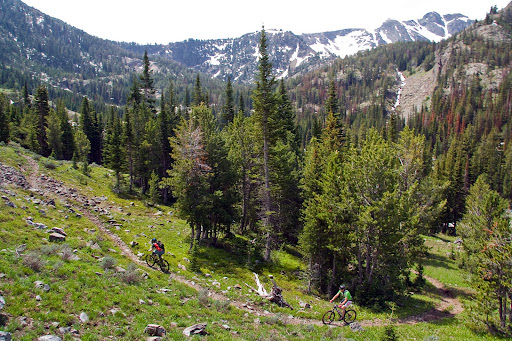
Sheep creek was a real gem of a trail, one of the best mountain lake trails I've ever ridden. It was dry up to just about 9,000' (right Denny?)and featured a 3 mile high speed meadow section second to none.

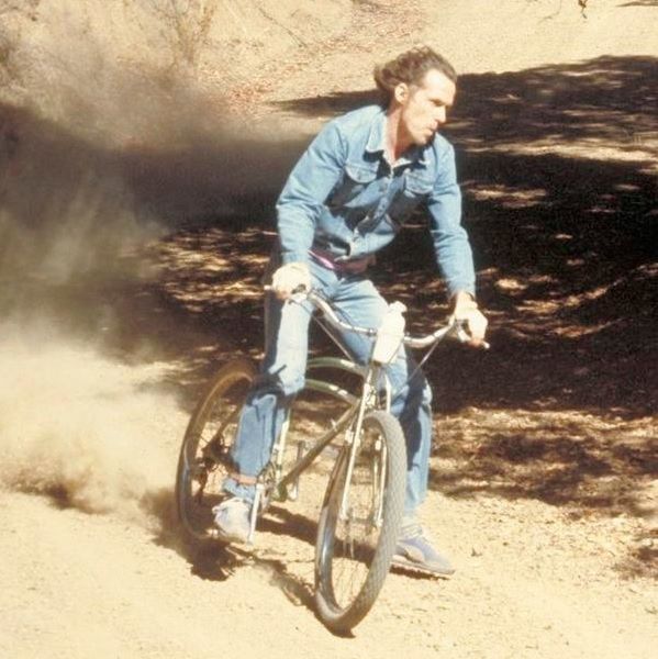
There's Denny and someone whose name escapes me.
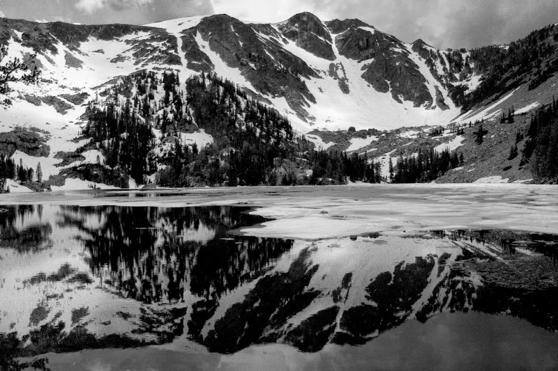

Here's the lake


Get out there and ride it, and write! Info here and from IMBA here and a easy to use form letter here.

Feel free to ignore the rest if you don't like looking at CSS.


#outer-wrapper {
width: 660px;
margin:0 auto;
padding:10px;
text-align:left;
font: normal normal 100% 'Trebuchet MS',Trebuchet,Verdana,Sans-serif;
}

#main-wrapper {
width: 410px;
float: left;


410 pixel width? optimized for all those people at 800x600 eh? Someone hates freedom. If this were my blog i'd do

#outer-wrapper {
max-width: 1000px;
margin:0 auto;
padding:10px;
text-align:left;
font: normal normal 100% 'Trebuchet MS',Trebuchet,Verdana,Sans-serif;
}
#content-wrapper {
width:auto;
}
#main-wrapper {
width: 66%;
min-width:400px;
max-width: 600px;
float: left;
word-wrap: break-word; /* fix for long text breaking sidebar float in IE */
overflow: hidden; /* fix for long non-text content breaking IE sidebar float */
}


(just joking, this blog is a great, thanks for letting me contribute)

Saturday, July 5, 2008

MMBA Advocacy Rides

I should have put this here earlier, but better late than never, right?
I got an email from Corey at Montana Mountain Bike Alliance a few days ago about some advocacy rides going on in the state. This weekend there's three:
  • July 4th, Continental Divide Trail at Mile Creek (yes, I'm aware that it was yesterday)
  • July 5th, Coffin Lake
  • July 6th, Sheep Lake
Meet at the Ridge Athletic club on Fallon. This is the new one that's out on the west side of town, not on Mendenhall next to Rocky Mountain Roasters.
These trails are in danger of being closed to mountain bikes by the Gallatin National Forest. I know that not too many folks from Bozeman make it out there, as it's a fairly long drive but they are crucial to the West Yellowstone mountain bike community. Go on these rides and write to the forest service about keeping these trails open. The comment period is over July 18th.
I went on the CDT ride yesterday with Corey and about 7 or 8 other folks. I've driven in the general area, mostly taking family past Quake Lake, but this was my first time riding in that part of the state. This trail and this area is among the most stunningly beautiful that I've ridden. All singletrack, you start climbing at a moderate grade through wildflower-ridden meadow. The trail makes its way into a drainage but stays lush and green while it climbs then falls in an undulating fashion (much like South Cottonwood). After a few miles of that, the trail starts with switchbacks, most of which are wide and fairly easy to ride. This section takes you up rapidly, with each turn providing another stunning view.
Then a rock broke my derailleur hanger, so that was the end of climbing for me. The others kept going, ultimately hitting snow and ditching their bikes to hike to the saddle and just into Idaho. I rode gingerly down since I had forgotten my bike shoes and I was riding with locked-out suspension and a single-speeded drivetrain. Despite this, the downhill was still incredible.
This is a trail that I'll definitely be going back to soon, but with my shoes. And a spare hanger. Get a few people together, carpool the best you can (and get the others to contribute to gas) and do the same. You don't want to miss this one.
Info Here.
If you have any questions, email Corey at cbiggers@rmtcinc.com.

Tuesday, July 1, 2008

New World Gulch

I knew it was going to be bad when I saw 3 signs at the trail head explaining how it was dangerous to go any further. I would say don't go up there until it gets fixed unless you like all of the following:

-Mosquitos in clouds
-Bogs in the trail
-Landslides
-missing trail next to the river
-slimy rocky creekbeds where the trail used to be

It wasn't horrible coming down (quite tricky), but I ended up pushing a good amount of the climb when I can normally ride most of it. Slimy rocks, trees, etc. I only went to where the trail dips down steeply before climbing to the meadow below Ellis. The horsemen had cleared the trail that far.

Anyone know if the state EVER gets around to fixing trails or are we out of luck on this one?